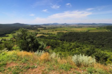
High Tatras from 36.000 ft (FL360) / 11 km
The High Tatras (Slovak: Vysoké Tatry) are a mountain range forming part of the Carpathian chain along the border between Slovakia and Poland. They represent the highest massif in the entire Carpathian arc, with Gerlachovský štít reaching 2,655 metres above sea level — the loftiest peak in both Slovakia and the Carpathians as a whole.
Despite their dramatic alpine character, the High Tatras are notably compact, spanning roughly 26 kilometres in length and 17 kilometres in width. The range features over 30 valleys, more than 100 glacial lakes known as plesá, and numerous waterfalls. Glacial activity during the Pleistocene epoch sculpted much of the landscape into its present rugged form.
The Slovak side was designated Tatra National Park (TANAP) in 1949, one of the oldest national parks in Central Europe. The area attracts millions of visitors annually, supporting significant tourism centred around the resort towns of Štrbské Pleso, Smokovec, and Tatranská Lomnica.
| 


 Album: