Ferlacher Stausee, Ferlach
by Jürgen77 · · Unterschloßberg, Austria · day · 4295 views
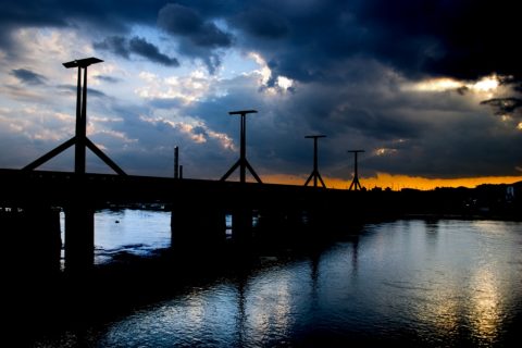
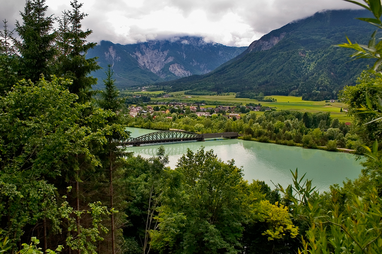
Railway bridge, as part of the railway line between Klagenfurt and Rosenbach (Rosentalbahn), across the Ferlach reservoir of the river Drau (Drava) near the castle Hollenburg in the community of Koettmannsdorf, district Klagenfurt-Land, Carinthia, Austria. In the background the mountain Ferlacher Horn.
Labels on this photo
-
Ferlacher Horn
Das Ferlacher Horn (auch Gerloutz genannt, slowenisch: Grlovec) erhebt sich mit einer Höhe von 1840 m ü. A. sehr markant im Süden von Ferlach. Von Kärntens Landeshauptstadt Klagenfurt ist das Ferlacher Horn gut sichtbar. Das Ferlacher Horn… Das Ferlacher Horn (auch Gerloutz genannt, slowenisch: Grlovec) erhebt sich mit einer Höhe von 1840 m ü. A. sehr markant im Süden von Ferlach. Von Kärntens Landeshauptstadt Klagenfurt ist das Ferlacher Horn gut sichtbar. Das Ferlacher Horn ist Teil der Karawanken. Wie vielfach in diesem Gebirge ist das Ferlacher Horn im Norden durch steile Abbruchzonen gekennzeichnet, im Süden jedoch durch Wald und - nur ganz oben unterhalb des Gipfels - durch Grasbewuchs.
-
Ferlacher Stausee
Der Ferlacher Stausee ist der Rückstau der Drau durch das Laufkraftwerk Ferlach-Maria Rain. Er reicht oberhalb bis zum Kraftwerk Feistritz-Ludmannsdorf. Während er nordseitig durch die Hänge der Sattnitz begrenzt ist, liegt er südseitig… Der Ferlacher Stausee ist der Rückstau der Drau durch das Laufkraftwerk Ferlach-Maria Rain. Er reicht oberhalb bis zum Kraftwerk Feistritz-Ludmannsdorf. Während er nordseitig durch die Hänge der Sattnitz begrenzt ist, liegt er südseitig teilweise höher als die unmittelbare Umgebung und wird dort durch einen Deich begrenzt.
- Ferlacher Stausee - Rosentalbahn bridge Name:: Ferlacher Stausee - Rosentalbahn bridge · Type/Design: (e.g.: suspension bridge): truss bridge · Crosses: (e.g.: east river): Ferlacher Stausee
-
Ferlach
Ferlach (Slovene: Borovlje) is the southernmost town in Austria, about 17 km south of the Carinthian capital Klagenfurt. It is situated in the Rosental/Rož Valley of the Drava River, at the northern slope of the Karawanken mountain range.… Ferlach (Slovene: Borovlje) is the southernmost town in Austria, about 17 km south of the Carinthian capital Klagenfurt. It is situated in the Rosental/Rož Valley of the Drava River, at the northern slope of the Karawanken mountain range. The commune consists of the Katastralgemeinden of Ferlach (Borovlje), Kappel an der Drau (Kapla ob Dravi), Kirschentheuer (Kožentavra), Unterloibl (Podljublj), Waidisch (Bajdiše), Unterferlach (Medborovnica), Glainach (Glinje), Seidolach (Ždovlje) and Windisch Bleiberg (Slovenji Plajberg). According to the 2001 census 8.3% of the population are Carinthian Slovenes.
Location on the map
Advertisement
Ad space (728×90)
Similar photos